



-
Bus, Airlines
-
Home Stay
-
5,416 metres
-
Kathmandu
-
Feb, Mar, Apr & May
-
Eco-Tour, Hiking
-
All meals during the trek
-
English, Spanish, French, Chinese
-
Easy to Moderate
-
2-15
-
12
-
65
Overview
Trek Overview
The Everest Three Passes Trek is one of the most complete and thrilling adventures in the Khumbu region, often considered the ultimate Himalayan circuit. Instead of solely following the standard trail to Everest Base Camp, this demanding route crosses three major mountain passes—each exceeding 5,300 meters—and pulls you through parts of the valley that most trekkers never see.
It perfectly aligns with Joli Himalaya Nepal’s mission of offering authentic cultural experiences combined with high-altitude trekking, guided by experienced local staff.
The Three High Passes
The defining feature of this trek is the traversal of three formidable passes:
-
Kongma La (5,535 m): Generally considered the highest and most physically demanding of the three passes. It features a rugged trail surrounded by glaciers and moraine valleys, linking Chhukhung to Lobuche.
-
Cho La (5,420 m): A steep, rocky climb that includes crossing a glacier. This pass connects the main Everest Base Camp route with the beautiful Gokyo Lakes trail.
-
Renjo La (5,360 m): The final pass on the circuit, marking the transition from the Gokyo Valley toward the Thame Valley. It is famously known for offering one of the most striking panoramic views of Mount Everest, Lhotse, Makalu, and the turquoise Gokyo Lakes below.
Highlights
- Trek to the world-famous Everest Base Camp
- Enjoy the amazing view of the Himalayas from Kala Patthar
- Travel through the Sherpa villages of Namche, Khumjung, Khunde, and Dingboche
- Visit Tengboche the biggest and oldest monastery n the region.
Itinerary
Flight to Lukla & Trek to Phakding
-
Starting Point: Kathmandu (1,400 m) or Ramechhap/Manthali
-
Destination: Phakding (2,610 m / 8,562 ft)
-
Via: Lukla (2,840 m / 9,317 ft)
-
Flight Duration: ~35 minutes
-
Trekking Duration: 3 to 4 hours
-
Distance: ~8 km (5 miles)
The Morning Flight Your day begins early with a transfer to the domestic airport for the famously scenic flight to Tenzing-Hillary Airport in Lukla. As you fly eastward, you will get your first panoramic views of the Himalayan range. Upon landing on Lukla's dramatic sloping runway, you will meet your local porter team, organized by your agency, to help carry your gear for the duration of the trek.
The Trail to Phakding After a brief rest and breakfast in Lukla, the trekking officially begins. The trail for Day 1 is deliberately paced to help with initial acclimatization. You will descend gradually towards the Dudh Koshi (Milky River), passing through lush green landscapes, small Sherpa farming villages like Chheplung and Ghat, and your first suspension bridges draped in colorful Tibetan prayer flags.
While early travel tended to be slower, more dangerous, and more dominated by trade and migration, cultural and technological advances over many years have tended to mean that travel has become easier and more accessible. The evolution of technology in such diverse fields as horse tack and bullet trains has contributed to this trend.
Trek to Namche Bazaar
-
Starting Point: Phakding (2,610 m / 8,562 ft)
-
Destination: Namche Bazaar (3,440 m / 11,285 ft)
-
Distance: 7.4 to 10 km (depending on specific starting/ending lodges)
-
Trekking Duration: 5 to 6 hours
-
Elevation Gain: ~830 m net gain
The Trail Along the Dudh Koshi The day begins by continuing north alongside the Dudh Koshi (Milky River). The trail undulates through pine forests and small villages like Tok Tok, Bhenkar, and Monjo. At Monjo, you will officially enter Sagarmatha National Park, where your permits will be checked.
You'll cross the river several times on suspension bridges, the most famous of which is the Hillary Suspension Bridge, strung high above the gorge, draped heavily with colorful prayer flags.
The Ascent to Namche After crossing the Hillary Bridge, the real work begins. The final section is a steep, continuous zigzag ascent up a forested ridge. It is a demanding climb, often taking about two hours. It is critical to take this section "bistari, bistari" (slowly, slowly) to allow your body to adjust to the thinning air.
About halfway up this climb, if the weather is clear, you will get your very first glimpse of Mount Everest peeking over the Lhotse-Nuptse ridge.
The day concludes as you crest the ridge and enter Namche Bazaar, a vibrant, amphitheater-shaped town built into the mountainside. It is the last major hub for supplies and a critical acclimatization stop.
The Acclimatization Hike
-
Base Location: Namche Bazaar (3,440 m / 11,285 ft)
-
Highest Point Reached: Hotel Everest View (3,880 m / 12,729 ft)
-
Hike Duration: 3 to 4 hours round trip
-
Elevation Gain/Loss: ~440 m up, ~440 m down
The Morning Ascent to Syangboche After breakfast, you will leave Namche and hike a steep trail up to the Syangboche airstrip. From there, you will continue your ascent to the famous Hotel Everest View. This ridge offers breathtaking, 360-degree views of the Himalayas, and on a clear morning, you will get your first unobstructed look at Mount Everest, Lhotse, and the iconic pyramid of Ama Dablam.
Exploring the Twin Villages From the hotel ridge, the trail descends slightly into the Khumbu Valley to visit the twin Sherpa villages of Khumjung (3,790 m) and Khunde (3,840 m). Known for their distinct green-roofed stone houses, these villages are the cultural heart of the region. Highlights often include visiting the Khumjung Monastery—which claims to house a Yeti skull—and the Khunde Hospital, founded by Sir Edmund Hillary.
Afternoon in Namche You will return to Namche Bazaar by early afternoon. The rest of the day is yours to rest, hydrate, and explore the town. Many trekkers use this time to visit the Sherpa Culture Museum, pick up last-minute gear from the local shops, or enjoy a coffee and pastry at the world's highest German bakery.
The top tips for acclimatizing safely during the Three Passes Trek
Day 4 of the Everest Three Passes Trek takes you from the busy Sherpa hub of Namche Bazaar to the spiritual center of the Khumbu region, Tengboche. This is often considered one of the most scenic walking days of the entire trek.
This day also aligns with the brand vision of Joli Himalaya Nepal Treks and Tours, offering that perfect blend of high-altitude adventure and authentic Himalayan heritage.
Trek to Tengboche
-
Starting Point: Namche Bazaar (3,440 m / 11,285 ft)
-
Destination: Tengboche (3,860 m / 12,664 ft)
-
Distance: ~8.6 to 9.2 km (5 to 5.7 miles)
-
Trekking Duration: 4 to 6 hours
-
Elevation Gain: ~420 m net gain (though the actual climbing is much higher due to the trail dropping to the river and climbing back up)
The Scenic Balcony Walk The day starts with a relatively flat and wide trail wrapping around the ridge out of Namche Bazaar. This section is essentially a "balcony walk" high above the Dudh Koshi river. If the morning is clear, you will be treated to sweeping, unobstructed views of Mount Everest, Lhotse, Nuptse, and the striking, sharp peak of Ama Dablam.
Descent to Phunki Tenga After enjoying the relatively easy walking and the massive mountain views, the trail descends sharply through rhododendron forests to a small riverside settlement called Phunki Tenga (3,250 m). This is the standard stop for a quick rest and a hot lunch before the day's main physical challenge.
The Climb to Tengboche Monastery From Phunki Tenga, the trail crosses a suspension bridge over the Dudh Koshi river and immediately begins a steep, relentless ascent up a long ridge. This climb usually takes about two hours and is a rigorous test of your acclimatization.
The reward at the top of the ridge is the village of Tengboche, home to the Tengboche Monastery (Dawa Choling Gompa), the largest and most active Buddhist monastery in the Khumbu region. The monastery sits on a broad meadow offering some of the most famous panoramic views in the world. As a guest of a locally-run agency like Joli Himalaya Nepal, your guide can often facilitate a respectful visit to the monastery to observe the monks during their afternoon chanting rituals.
Day 5 of the Everest Three Passes Trek takes you deeper into the Khumbu Valley, leaving the tree line behind as you move from Tengboche to the high-altitude settlement of Dingboche. This section offers a dramatic shift in landscape and continuous views of some of the Himalayas' most iconic peaks.
Trek to Dingboche
-
Starting Point: Tengboche (3,860 m / 12,664 ft)
-
Destination: Dingboche (4,410 m / 14,468 ft)
-
Distance: ~10.5 km (6.5 miles)
-
Trekking Duration: 5 to 6 hours
-
Elevation Gain: ~550 m net gain
Descending to the Imja Khola The morning begins with a descent from the Tengboche ridge through forests of birch, conifer, and rhododendron to the village of Debuche. This is often an excellent place to spot Danphe (the Himalayan Monal pheasant) and musk deer. The trail continues to drop slightly until you cross the roaring Imja Khola river over an exciting steel suspension bridge.
Climbing Above the Tree Line After crossing the river, the trail begins a steady ascent toward Pangboche, the highest year-round settlement in the valley. As you climb, you will notice a distinct change in the environment: the tall trees give way to alpine scrub and dwarf vegetation.
Pangboche is an excellent spot for a tea break and features the oldest monastery in the Khumbu region. The path here is flanked by thousands of Mani stones (stones carved with Buddhist mantras).
The Push to Dingboche Leaving Pangboche, the trail continues to climb gradually into the Imja Valley. The towering form of Ama Dablam dominates the view directly ahead and to your right. You will pass through the grazing pastures of Shomare and Orsho before the final, somewhat steep push up to Dingboche.
Dingboche is a patchwork of fields enclosed by stone walls built to protect crops from the cold winds. It is an essential acclimatization stop before tackling the higher passes, aligning with the safety-first protocols standard on Joli Himalaya Nepal's guided expeditions.
Day 6 of the Everest Three Passes Trek is your second scheduled acclimatization day, spent at the high-altitude settlement of Dingboche. Because you are now officially above 4,400 meters, this rest day is absolutely vital before pushing higher toward the Kongma La Pass or Everest Base Camp.
The Acclimatization Hike to Nangkartshang Peak
-
Base Location: Dingboche (4,410 m / 14,468 ft)
-
Target Viewpoint: Nangkartshang Peak (approx. 5,083 m / 16,676 ft)
-
Hike Duration: 4 to 5 hours round trip
-
Elevation Gain/Loss: ~670 m up, ~670 m down
The Morning Ascent Following the "climb high, sleep low" rule, your local guides will lead you on a steep hike up the ridge directly behind Dingboche. The destination is Nangkartshang Peak (sometimes spelled Nagarjun Hill). The trail is strenuous, dusty, and requires you to move very slowly, taking frequent breaks to catch your breath.
The Summit Views Reaching the viewpoint is one of the visual highlights of the entire trek. From the top, you are rewarded with sweeping panoramic views that showcase the natural wonder of Nepal. You will see:
-
Makalu (8,485 m): The fifth highest mountain in the world, visible to the east.
-
Ama Dablam (6,812 m): The most iconic, perfectly shaped peak in the region, visible in its entirety from base to summit.
-
Lhotse (8,516 m) & Nuptse (7,861 m): The massive walls of rock and ice towering over the valley.
-
The Imja Valley: The stunning glacial valley stretching out below you, leading toward Island Peak.
Afternoon Recovery After taking in the views and letting your body experience the 5,000-meter altitude, you will descend back to Dingboche for a hot lunch. The afternoon is dedicated to rest. Use this time to hydrate aggressively, organize your gear, or visit one of the local bakeries to recharge.
Joli Himalaya Nepal utilizes experienced support staff to monitor your health upon returning, ensuring you are acclimatizing properly and recovering for the next day's push deeper into the wilderness.
Day 7 of the Everest Three Passes Trek is a relatively short but crucial transitional day. It takes you from Dingboche up the Imja Valley to the small settlement of Chhukhung. This day positions you right at the base of the first major hurdle of the circuit: the Kongma La Pass.
Trek to Chhukhung
-
Starting Point: Dingboche (4,410 m / 14,468 ft)
-
Destination: Chhukhung (4,730 m / 15,518 ft)
-
Trekking Duration: 2.5 to 3.5 hours
-
Elevation Gain: ~320 m net gain
Walking the Imja Valley Because the distance is short, you can enjoy a slightly later breakfast in Dingboche. The trail departs the village and heads eastward, gently climbing up the Imja Valley. The walking here is generally pleasant and less steep than previous days, though the altitude makes every step feel heavier.
As you walk, you are surrounded by glaciers and massive peaks. The trail is flanked by the towering South Face of Lhotse to your left and the continuing presence of Ama Dablam to your right. You will pass through summer yak pastures and small, stone-walled herders' huts in the area known as Bibre (4,570 m).
Arrival in Chhukhung After crossing a few icy streams, you will arrive at Chhukhung. This is not a traditional village, but rather a small cluster of lodges built specifically to serve trekkers and climbers heading for Kongma La or Island Peak. It feels distinctly more rugged and isolated than Dingboche, sitting starkly against the glacial moraines.
Afternoon Activity: Chhukhung Ri (Optional but Recommended) Since you will likely arrive in Chhukhung before lunch, the afternoon is often used for an acclimatization hike up Chhukhung Ri (5,550 m). This is a tough, steep climb, but the summit offers one of the most spectacular, close-up views of the Lhotse face, Makalu, and the jagged glaciers below. Completing this hike is excellent preparation for crossing the 5,535-meter Kongma La Pass the following day.
Day 8 is arguably the most demanding and rewarding day of the entire Everest Three Passes Trek. Today, you tackle Kongma La, the highest of the three passes, before navigating the challenging Khumbu Glacier to reach Lobuche.
This segment perfectly illustrates why Joli Himalaya Nepal Treks and Tours emphasizes safety, local expertise, and responsible travel. The trail is rugged, the altitude is extreme, and successfully crossing the glacier relies heavily on experienced guides and support staff familiar with Nepal’s mountain terrain.
Trek from Chhukhung to Lobuche via Kongma La
- Starting Point: Chhukhung (4,730 m / 15,518 ft)
- Highest Point: Kongma La Pass (5,535 m / 18,159 ft)
- Destination: Lobuche (4,910 m / 16,108 ft)
- Trekking Duration: 7 to 9 hours
- Elevation Gain/Loss: ~805 m up, ~625 m down
The Ascent to Kongma La The day begins well before dawn. Leaving Chhukhung, the trail immediately becomes steep and faint as it winds through a rocky, grassy valley. You will follow a ridge line that gradually turns into a strenuous slog over loose scree and boulders. Because there are no teahouses on this route, you must carry a packed lunch and plenty of water.
After several hours of gruelling climbing, you will reach the summit of Kongma La (5,535 m). The pass is marked by colorful Tibetan prayer flags draped over mountain cairns. From this vantage point, the reward is a staggering, unobstructed panorama featuring Makalu, Lhotse, Nuptse, and the icy expanse of the Khumbu Glacier far below.
The Descent and the Khumbu Glacier Crossing The descent from the pass is arguably trickier than the ascent. It is incredibly steep, dropping sharply over loose scree and icy rocks toward the Khumbu Glacier.
Once off the steep descent, you face the final major hurdle of the day: crossing the glacier itself. The path across the moraine is constantly shifting due to moving ice, making it undulating, rocky, and difficult to navigate. This is where your local guide's expertise is crucial to finding the safest, most stable route through the boulder fields and ice formations.
After successfully navigating the glacier, a short climb brings you to the main Everest Base Camp trail, where you will soon arrive at the bustling outpost of Lobuche for a well-earned rest.
Day 9 is the culmination of a major milestone on the Everest Three Passes Trek: reaching the iconic Everest Base Camp (EBC).
Trek from Lobuche to Gorak Shep & Everest Base Camp
- Starting Point: Lobuche (4,910 m / 16,108 ft)
- Lunch & Sleeping Altitude: Gorak Shep (5,164 m / 16,942 ft)
- Highest Point: Everest Base Camp (5,364 m)
- Trekking Duration: 7 to 8 hours total
- Elevation Gain: ~454 m net gain to EBC
The Morning Push to Gorak Shep
The day begins with a gradual hike along the valley before the trail turns rougher as it enters the lateral moraine of the Khumbu Glacier. The path is rocky, undulating, and requires careful footing. After about 3 hours of trekking, you will arrive at Gorak Shep, a small, sandy outpost that serves as the final settlement before EBC. Here, you will check into your teahouse, drop off your heavy gear, and have an early lunch.
Reaching Everest Base Camp
Leaving your main packs behind at the lodge, you will begin the final 2-to-3-hour round trip hike to Base Camp. The trail continues along the rocky crest of the glacier's moraine, winding through ice pinnacles and boulder fields.
Arriving at EBC is a deeply rewarding moment. You will likely see the colorful Tibetan prayer flags draped over mountain cairns and the iconic painted stone elevation marker reading "Everest Base Camp 5364m"—a signature image of the Himalayan adventure your agency provides. While you cannot see the peak of Mount Everest from Base Camp itself, you will have an incredible view of the treacherous Khumbu Icefall, the gateway for climbers attempting the summit.
Return to Gorak Shep After taking photos and celebrating the achievement, you will trek back down the moraine to Gorak Shep to rest for the night. Since you are sleeping at over 5,100 meters, Joli Himalaya Nepal guides prioritize monitoring your health and managing altitude exposure to ensure safe wilderness travel.
Day 10 transitions from the main Everest Base Camp trail over to the Gokyo valley route via a scenic, relatively short hike from Lobuche to Dzongla (also spelled Jhongla). This day is essentially a preparation stage for the strenuous Cho La pass crossing scheduled for the next morning.
Trek to Dzongla
- Starting Point: Lobuche (4,910 m / 16,108 ft)
- Destination: Dzongla (4,830 m / 15,846 ft)
- Distance: ~6.5 km (4 miles)
- Trekking Duration: 3 to 4 hours
- Elevation: Minor net descent, though the trail undulates.
Leaving the Khumbu Glacier The morning starts by retracing your steps slightly south from Lobuche, walking alongside the lateral moraine of the Khumbu Glacier. Instead of continuing all the way down to Dingboche or Pheriche, the trail forks to the right (west). You will cross a stream and begin a steady climb up a grassy ridge that contours around Awi Peak.
The Scenic Traverse Once on the ridge, the walk becomes one of the most visually stunning traverses of the entire trek. You are treated to sweeping views of the valley below and the spectacular North Face of Cholatse (6,440 m) looming directly ahead. The towering peak of Taboche (6,367 m) and the familiar shape of Ama Dablam dominate the skyline to the south.
The trail itself is relatively gentle, undulating over high pastures. This manageable pace removes the physical friction often associated with consecutive long days in the mountains, allowing you to simply enjoy the "unforgettable pleasure" of the Himalayan landscape.
Arrival at Dzongla After cresting a final small ridge, you will descend into a bowl-shaped valley and arrive at Dzongla. This is a very small, isolated settlement consisting of just a few teahouses. It exists primarily as a staging ground for trekkers preparing to cross the Cho La Pass. You will arrive well before lunch, giving you the entire afternoon to rest, hydrate, and prepare your gear for the challenging ascent the following day.
Day 11 is arguably the most technical and demanding day of the entire Three Passes Trek. Today, you tackle the formidable Cho La Pass, navigating steep rock scrambles and a glacier crossing to connect the Everest Base Camp route with the Gokyo Valley.
Trek from Dzongla to Dragnag via Cho La Pass
- Starting Point: Dzongla (4,830 m / 15,846 ft)
- Highest Point: Cho La Pass (5,420 m / 17,782 ft)
- Destination: Dragnag / Thangnak (4,700 m / 15,420 ft)
- Trekking Duration: 7 to 9 hours
- Elevation Gain/Loss: ~590 m up, ~720 m down
The Approach and the Rock Scramble
The day starts very early to ensure you cross the pass before the mid-day winds pick up. Leaving Dzongla, the trail heads west, initially offering a relatively gentle walk through a valley with stunning views of Cholatse. However, the path quickly becomes steep as you approach the pass.
The final ascent to Cho La involves a rigorous scramble over large boulders and loose scree. This section is strenuous and requires careful footing. As you near the top, the path narrows and zigzags steeply up a rock wall.
The Glacier Crossing Reaching the top of the pass is a major milestone, marked by the iconic Tibetan prayer flags fluttering against the wind. But the work isn't over. Immediately over the pass lies a glacier that you must cross.
Depending on the season, this glacier can be hard ice or covered in soft snow. Your local guide is essential here to find the safest route across the ice, avoiding crevasses and slippery sections. Micro-spikes or crampons are often highly recommended for this stretch.
The Descent to Dragnag
After crossing the glacier, the descent into the Gokyo Valley begins. This side of the pass is notoriously steep and prone to rockfall, so you must move carefully but efficiently. The trail drops down into a rocky gully before eventually smoothing out as you approach the small settlement of Dragnag (also spelled Thangnak).
Dragnag sits just at the edge of the massive Ngozumpa Glacier and serves as the perfect resting spot to recover from the rigorous crossing of Cho La.
Day 12 is a relatively short but spectacularly scenic day. After the strenuous crossing of Cho La, today's objective is to cross the longest glacier in the Himalayas and arrive at the pristine, turquoise waters of the Gokyo Lakes.
Trek from Dragnag to Gokyo
- Starting Point: Dragnag / Thangnak (4,700 m / 15,420 ft)
- Destination: Gokyo (4,790 m / 15,715 ft)
- Trekking Duration: 3 to 4 hours
- Elevation Gain: ~90 m net gain
Crossing the Ngozumpa Glacier The morning begins by leaving Dragnag and immediately climbing up the lateral moraine to access the Ngozumpa Glacier. Spanning 36 kilometers, it is the longest glacier in the Nepalese Himalayas.
The path across the glacier is not a flat walk of ice, but rather a chaotic, undulating landscape of boulder-strewn ice mounds, frozen meltwater pools, and loose scree. Because the glacier is constantly shifting and melting, the trail changes from season to season. This is where relying on the local expertise of your Joli Himalaya Nepal guides is essential—they are deeply familiar with Nepal's mountain terrain and know how to navigate the safest route through the moraine.
Arrival at the Gokyo Lakes After navigating the glacier, the trail climbs up the far lateral moraine and seamlessly joins the main Gokyo Valley route. As you walk north, you will pass the second Gokyo lake (Taboche Tsho) before finally arriving at the third lake, Dudh Pokhari.
The village of Gokyo sits right on the eastern shore of this breathtakingly blue lake, perfectly framed by the towering peak of Cho Oyu (8,188 m) in the background. Because today's hike is short, you will arrive in Gokyo by lunchtime. The entire afternoon is free to rest, enjoy a hot meal, and soak in one of the most stunning alpine settings in the world.
Day 13 is one of the absolute visual highlights of the entire Everest Three Passes Trek. Today is dedicated to climbing Gokyo Ri, a rocky peak that offers what many consider the single best panoramic view in the entire Khumbu region.
The Climb to Gokyo Ri Viewpoint
- Starting Point: Gokyo Village (4,790 m / 15,715 ft)
- Highest Point: Gokyo Ri (5,357 m / 17,575 ft)
- Hike Duration: 3 to 4 hours round trip
- Elevation Gain/Loss: ~567 m up, ~567 m down
The Early Morning Ascent
To catch the clearest views and the dramatic sunrise colors, this hike begins well before dawn. Leaving your teahouse in Gokyo, you will cross a small stream and immediately begin a relentless, steep zigzag ascent up the mountainside directly above the village.
The climb is physically demanding, especially in the thin, freezing morning air. Relying on the pacing and guidance of your experienced Joli Himalaya Nepal guides is crucial here to ensure a safe, steady ascent.
The Summit Panorama As you crest the summit, marked by fluttering Tibetan prayer flags, the sheer scale of the Himalayas reveals itself. The 360-degree panorama is staggering. You will have a clear, unobstructed view of four 8,000-meter peaks:
- Mount Everest (8,848 m): Standing prominently, often with a plume of snow blowing off its summit.
- Lhotse (8,516 m) & Makalu (8,485 m): Towering to the east.
- Cho Oyu (8,188 m): Dominating the border with Tibet to the north.
Looking straight down, you can see the massive, sprawling ice of the Ngozumpa Glacier and the string of vibrant, turquoise Gokyo Lakes glistening in the morning light.
Afternoon at the Lakes After taking in the majestic views, you will descend back to Gokyo village for a late, hearty breakfast. The rest of the day is generally reserved for resting, giving your body time to recover before tackling the final pass (Renjo La) the following day. Some trekkers choose to take a short, flat walk to explore the fourth and fifth Gokyo lakes further up the valley in the afternoon.
Day 14 presents the final major high-altitude challenge of the Everest Three Passes Trek: crossing the spectacular Renjo La Pass and descending into the remote Bhote Koshi valley towards Lungden.
Trek from Gokyo to Lungden via Renjo La Pass
- Starting Point: Gokyo Village (4,790 m / 15,715 ft)
- Highest Point: Renjo La Pass (5,360 m / 17,585 ft)
- Destination: Lungden (4,368 m / 14,330 ft)
- Trekking Duration: 7 to 8 hours
- Elevation Gain/Loss: ~570 m up, ~992 m down
The Ascent from Gokyo The day begins early by leaving Gokyo village and walking north along the edge of Dudh Pokhari (the third Gokyo lake). The trail soon cuts west and begins a steep, relentless zigzag climb up the mountainside. The path is often dusty and can be challenging in the thin air, requiring you to move slowly and steadily.
As you climb higher, the views behind you become increasingly spectacular. Just before reaching the pass, you are treated to what many consider the single greatest viewpoint in the Khumbu region, delivering that true "unforgettable pleasure" of experiencing the natural wonder of Nepal. The turquoise Gokyo lakes sit far below, perfectly framed by the towering peaks of Mount Everest, Lhotse, Makalu, and Cho Oyu.
Crossing the Pass The summit of Renjo La is a narrow, rocky notch adorned with colorful Tibetan prayer flags draped over mountain cairns—a signature sight on Joli Himalaya Nepal's guided expeditions. After resting and taking photos, you will begin the descent into the Bhote Koshi valley.
The Descent to Lungden The initial descent from Renjo La is notoriously steep, rocky, and can be icy depending on the season. Your guide will help you navigate this tricky section safely. The trail eventually levels out, passing a beautiful, isolated glacial lake called Relama Tsho.
You will then drop down into a wide, dry valley that feels distinctly different from the rest of the Khumbu. This valley served as an ancient trade route between Nepal and Tibet. By mid-to-late afternoon, you will arrive at Lungden, a small, remote settlement with just a few teahouses, where you can rest after conquering the final pass of the circuit.
Day 15 is a long but deeply rewarding descent as you leave the remote, high-altitude terrain of the Bhote Koshi valley and make your way back to the bustling Sherpa capital of Namche Bazaar. This leg of the journey is rich in cultural history, passing through traditional villages that were once key stops on the ancient salt trade route with Tibet.
Trek from Lungden to Namche Bazaar via Thame
- Starting Point: Lungden (4,368 m / 14,330 ft)
- Intermediate Stop: Thame (3,800 m / 12,467 ft)
- Destination: Namche Bazaar (3,440 m / 11,285 ft)
- Distance: ~10 to 13 km (6 to 8 miles)
- Trekking Duration: 5 to 7 hours
- Elevation: ~928 m net descent
Descending to Thame The morning begins with a steady descent from Lungden, following the Bhote Koshi River southward. The landscape here is stark and dry, contrasting sharply with the lush lower Khumbu valleys. The trail is relatively easy, passing through small, traditional herding settlements like Marulung and Taranga.
After about 3 to 4 hours of walking, you will arrive at the village of Thame. Thame is one of the oldest and most culturally significant villages in the Khumbu region. It is famously the childhood home of Tenzing Norgay (the first man to summit Everest alongside Sir Edmund Hillary) and Kami Rita Sherpa (who holds the record for the most Everest summits).
The Thame Monastery If time permits and your guide recommends it, a short detour to the Thame Monastery (Dechen Chokhorling Gompa) is highly encouraged. Perched on a cliff above the village, it is one of the oldest monasteries in the region and offers a profound glimpse into the spiritual heart of the Sherpa people—a core aspect of the Himalayan heritage your agency emphasizes.
The Return to Namche After a hot lunch in Thame, the trail continues downward. You will cross a dramatic suspension bridge over the deep gorge of the Bhote Koshi river. The path then undulates through pine and rhododendron forests, passing through the villages of Samde and Thamo.
As you round the final ridges, the familiar amphitheater shape of Namche Bazaar comes into view. Arriving back in Namche feels like returning to civilization. You can celebrate completing the three passes with a hot shower, a good cup of coffee, or a visit to the local bakery—enjoying the well-earned comfort after your rugged mountain journey.
Day 16 is the final trekking day of the Everest Three Passes Trek. It is a long but celebratory walk that takes you out of the high mountains, back through the lush lower Khumbu valleys, and finally into the bustling airstrip town of Lukla.
This concluding leg encapsulates the "unforgettable pleasure" and natural wonder of Nepal that Joli Himalaya Nepal Treks & Tours aims to deliver. With the safety and logistical support of your local guides and porters, you can reflect on the massive achievement of crossing three 5,300-meter passes.
Trek from Namche Bazaar to Lukla
- Starting Point: Namche Bazaar (3,440 m / 11,285 ft)
- Destination: Lukla (2,840 m / 9,317 ft)
- Distance: ~18 km (11 miles)
- Trekking Duration: 6 to 8 hours
- Elevation: ~600 m net descent (though it involves a final ascent into Lukla)
The Long Descent The day starts with a steep, knee-testing descent from the Namche Bazaar ridge. You will drop back down into the pine forests, crossing the famous Hillary Suspension Bridge once more. From here, the trail levels out significantly as you follow the Dudh Koshi (Milky River) southward.
You will pass back through the Sagarmatha National Park checkpoint at Monjo, officially exiting the protected high-altitude zone. The air here feels thick and rich with oxygen compared to the high passes, making the walking feel much easier despite the long distance.
The Final Push to Lukla The trail rolls through familiar farming villages like Phakding, Ghat, and Chheplung—places you passed on your very first day. The final hour of the trek involves a steady, sometimes tiring uphill climb from Chheplung into the town of Lukla.
Celebrating the Journey Arriving in Lukla is a momentous occasion. This bustling town, anchored by the Tenzing-Hillary Airport, is the gateway to the Khumbu. It is a Joli Himalaya Nepal tradition to spend this final evening celebrating with your guide and porter team. You can finally enjoy a hot shower, a celebratory meal, and perhaps a drink at one of Lukla's cafes, reminiscing about the rugged wilderness adventure you have just completed.
Day 17 brings your incredible high-altitude wilderness adventure to a close with a thrilling morning flight out of the Khumbu region and a return to the vibrant Kathmandu Valley.
Flight to Kathmandu & Trip Conclusion
- Starting Point: Lukla (2,840 m / 9,317 ft)
- Destination: Kathmandu (1,400 m / 4,593 ft)
- Flight Duration: ~35 minutes
The Morning Flight Flights out of Tenzing-Hillary Airport operate early in the morning to avoid the high winds that develop later in the day. After a final breakfast in the mountains, you will board the twin-otter aircraft for the short, scenic flight back to Kathmandu (or Manthali/Ramechhap, depending on the season's flight regulations). As the snow-capped peaks fade into the distance, you can reflect on the "unforgettable pleasure" and awe of the mountain landscapes you just traversed.
Arrival and Hotel Transfer Upon landing at the domestic terminal, the support staff from Joli Himalaya Nepal will meet you and provide a private transfer back to your hotel in Kathmandu. Returning to the city's thick, oxygen-rich air and modern comforts—like a long, hot shower and a soft bed—feels incredible after weeks in the rugged alpine terrain.
Afternoon Leisure & Farewell The afternoon is entirely free for you to rest, enjoy a celebratory meal in Thamel, or do some final souvenir shopping. Because Joli Himalaya Nepal also specializes in authentic cultural tours, their team can easily organize an afternoon visit to UNESCO World Heritage sites like Kathmandu Durbar Square, Boudhanath, or Pashupatinath if you wish to continue exploring the traditions of Nepal.
In the evening, it is common to gather for a farewell dinner to celebrate the successful completion of your Himalayan expedition with your guides and fellow trekkers.
Cost
The Cost Includes
- Pick-up or Drop-off service from and to Airport(in our own vehicle)
- Transportation to and from!!
- Food all along the trip(Breakfast, Lunch, Dinner and a cup of coffee or tea) and accommodations during the trip in hotels with family environment
- Transportation, food, accommodation and insurance of Guide during the trip
- Down jacket, all-season sleeping bag, duffel bag and trekking map(in case if you don’t have your own. Down jacket, sleeping bag and duffel bag must be returned after completion of the trip)
- First Aid Medical Kit(Your guide will carry the Medical Kit but we also advise to bring yourself for your own use, as far as possible)
- All the required permits and paperwork
The Cost Excludes
- International Airfare
- Visa Charges
- Hotel Expenses(In Kathmandu, some packages do include hotel expenses)
- Your travel and medical insurance
- Personal Expenses such as shopping, bar bills, hot shower, telephone, laundry, titbits etc
- Food and accommodations in Kathmandu
- Services not mentioned or not promised by the agent/agency
- Emergency expenses such as expenses on chartered helicopter.
All About Your Trek
Embark on an exhilarating trekking journey that immerses you in the pristine beauty of nature and the rich cultural heritage of the region. This trek offers a perfect blend of adventure, breathtaking scenery, and meaningful local encounters, making it an ideal choice for those seeking to connect deeply with the environment and people.
Route & Terrain:
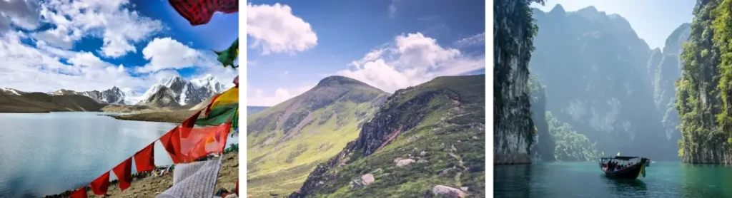
The trek covers a diverse landscape, ranging from dense forests and terraced fields to rocky mountain paths and high-altitude meadows. You’ll traverse well-marked trails that challenge your endurance while rewarding you with spectacular panoramic views. Some sections may involve steep ascents and descents, so a good level of physical fitness and stamina is recommended.
Duration & Pace:
This trek typically lasts [X days], allowing you to enjoy a balanced pace that combines daily trekking with time to rest and explore local villages. Each day’s walk averages between 4 to 7 hours, giving you ample opportunity to soak in the scenery and capture stunning photographs.
Accommodation & Facilities:
Overnight stays are arranged in traditional teahouses or mountain lodges, offering basic yet comfortable amenities. These cozy accommodations provide a chance to experience the warmth of local hospitality, enjoy hearty home-cooked meals, and recharge for the next day’s trek.
Cultural Experience:
Beyond the natural beauty, this trek provides a unique window into the life of indigenous communities. You’ll meet friendly locals, learn about their customs, traditions, and way of life, and perhaps even participate in cultural activities or festivals depending on the timing of your visit.
Best Time to Visit:
The optimal trekking seasons are during the spring months of March to May and the autumn months of September to November. During these periods, the weather is generally clear and stable, with moderate temperatures and minimal rainfall, ensuring safer trekking conditions and breathtaking visibility.
Preparation & Packing Tips:
To make the most of your trek, pack wisely. Essential items include sturdy trekking boots, layered clothing for fluctuating temperatures, rain gear, sun protection such as hats and sunscreen, a reusable water bottle, and personal medication. It’s advisable to keep your backpack light and prioritize comfort and functionality.
Health & Safety:
Your safety is our utmost priority. The trek is guided by experienced professionals who are well-versed in mountain safety and first aid. They continuously monitor weather and trail conditions to ensure a secure experience. Remember to stay hydrated, pace yourself, and communicate any discomfort to your guide immediately.
Environmental Responsibility:
We encourage all trekkers to practice responsible tourism by minimizing waste, respecting wildlife, and preserving the natural environment. Carry out all trash, avoid disturbing flora and fauna, and support local conservation efforts by purchasing souvenirs directly from artisans.
Additional Support:
Should you have any specific requirements or need assistance in planning your trek, our team is available to provide personalized advice and support. We also offer options for porter services or mule assistance to help carry your luggage, making your trek more comfortable.